6 August 2016 | Mri Grout
| Difficulty: Easy - Hard | Trails: Loops, Circuits, & Returns |
| Lowest Elevation: 500m | Highest Elevation: 600m |
| Distance: 1-10 kilometers | Amenities: Water, Picnic Area |
| Free Camping: Yes | Doable Seasons: All |
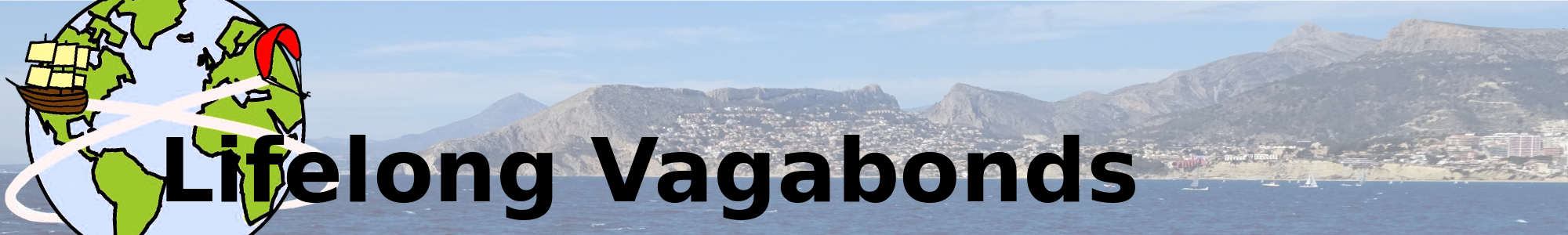
A beautiful and shady hike near Nonihay, Estrecho de la Arboleja is a must do for anyone looking for free things to do near Murcia. Not only is it home to some amazing rock formations, but it's also criss-crossed with old water irrigation tunnels one can crouch through and scary bridges one can inch across at their own risk. This Estrecho de la Arboleja hike is great both for the whole family to explore as it is one of the many short hikes near Murcia and for experienced hikers and canyoners as it can easily be made into a fairly difficult 10 kilometres circuit.
Sorry for the ads, but food is needed. So if you turn off your ad blocker you could buy us a sandwich!
Things to Know Before Hiking Estrecho de la Arboleja
- Bring shoes you're prepared to get wet and muddy. Even in July, there are puddles at the bottom of the canyon and inches of mud in some of the water irrigation tunnels.
- Bring a torch/flashlight for checking out nooks and crannies and said irrigation tunnels (again, at your own risk)
- If you're planning on doing the longer hike, pack a whole backpack full of water. Even though there is a lot of shade available nearly the entire way through the canyon, it's still freaking hot and there aren't any other drinkable water sources except for at the start. If you think you don't have enough at any point throughout the hike, then please don't think turning back is a cowardly act. Though even if it is, would you rather be a coward or full on stupid?
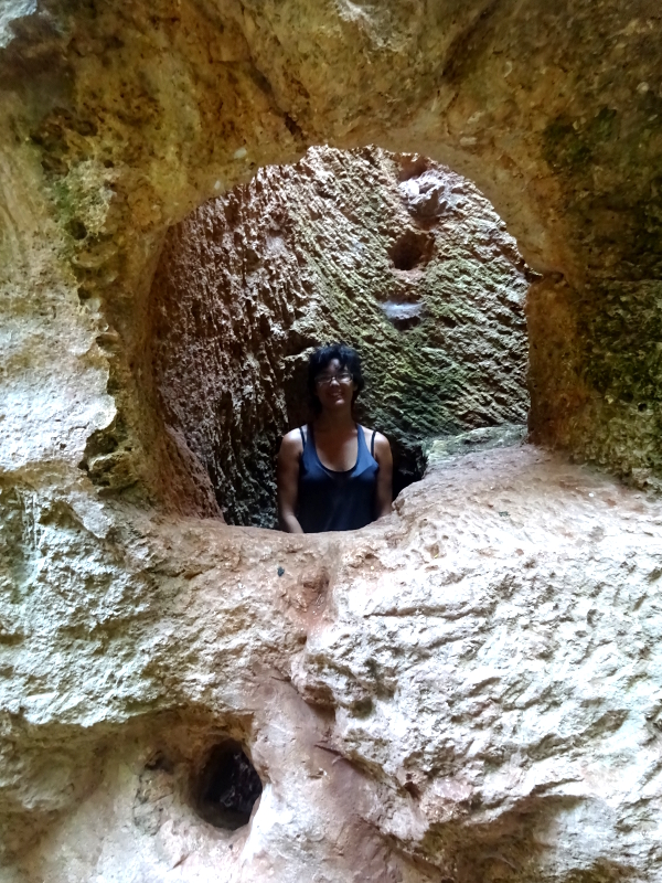
- Also, I would highly recommend taking a rope and harness if you're attempting to do the longer hike. It is possible to do so without (as we did), but only if you have experience climbing and actually know what you are doing. There were some places we refused to climb with a backpack so ended up throwing them down and then following (though via climbing, not jumping), so it is fairly difficult in about three places and downright impossible in one (we had to find another way around).
- I'm not sure what the official rules are about wild camping nearby Estrecho de la Arboleja other than the common ones: NO CAMPFIRES, leave it how you found it, and don't camp in someone's fields or backyard without their permission. The flattest spots are less than 600 metres away from the main part of the canyon. Anywhere after the small electricty station will be tough finding a nice flat place to camp.
Different Hikes in Estrecho de la Arboleja
Easy Hike: 1-2 kilometers- At the far end of the carpark is a well made path with green handrails. Follow these steps all the way down to the bottom, ignoring the other dirt trails for now.
- Once you get to the bottom of the stairs, turn to the right and follow the path under some trees and then into the cool canyon walls of Estrecho de la Arboleja. From here, there are numerous options to further your hike such as sneaking through the old water irrigation tunnels, climbing up the steep rock ladder and onto a dirt path, or simply following the canyon until it runs into the same dirt trail.
- At the bottom of the stairs with the green handrails, head down the canyon away from the carpark. There are loads of different trails that all run in the same direction and meet up in multiple crosses along the way, but I would recommend walking along the higher left hand side so you can check out the cool 'bee-hive' rock formations and ruins. I would keep on this until you pass the old water bridge and then drop down a ledge to stay in the shade.
- HEADS UP!!!! Once you pass the tarmac road about a kilometre south of the main bit, the challenge of this canyon hike increases a lot. I would recommend that those that attempt this have some canyoning or climbing experience, as well as a harness and rope. See the tips above for more details or check out the picture of me butt shuffling between two rocks to see what will be required of one without gear.
- If you're good to go, follow the canyon across the road and continue down it until its steep sides begin to drop away (about three or four kilometres). At this point there will be some groves above you on your right hand side and two dirt tracks to choose from. Take the left one and continue up it until you reach tarmac. Keep going until it runs into another road and then turn left again. Stay on this until you reach the first proper road on your left hand side (about six hundred metres). Take this and when you get back to the section of road you crossed near the beginning of this hike, get off it on the right hand side and head back towards the main bit of Estrecho de la Arboleja.
Driving Directions to Estrecho de la Arboleja
GPS Coordinates: 37°47'18.9"N 1°35'36.6"W The GPS coordinates mentioned here aren't exactly pinpointed where the Estrecho de la Arboleja hike is, but only because Google Maps doesn't know that the road carries on. So when you get to the place I have marked and it comes to a sort of Y, keep to the left. You will soon get to a wide open area with a couple of large picnic buildings. Parking is free and unmarked.
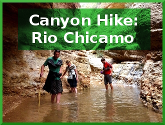
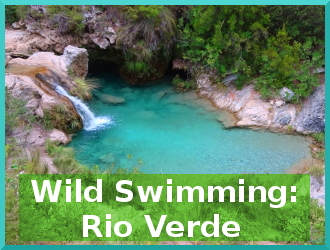
If you liked 'Canyon Hiking in Estrecho de la Arboleja' you might also like these other free things to do in Spain:


Travel Tip #4

Have you hiked Estrecho de la Arboleja?